
Warren County Genealogical Society
Warren County, Ohio
Chapter of Ohio Genealogical Society
Township Maps
(513) 695-1144
![]()
406 Justice Drive, Lebanon, Ohio 45036
Hours: 9 AM-4 PM Monday through Friday
Driving Directions
![]()
|
|
Warren County Genealogical Society |
|
|
(513) 695-1144
|
|
wcgs@co.warren.oh.us |
|
|
||
|
|
|
|
|
|
|
This series of maps were created by Tom Foley in 2006 for use in a presentation by Harriet Foley at the April, 2006 meeting of the Warren County Genealogical Society. The maps and Harriet's presentation have also been published in the Summer, 2006 issue of "Heir Lines".
With Tom's permission, images of the maps are provided below along with a brief synopsis of the the changes made [Click on the thumbnails for larger images.]
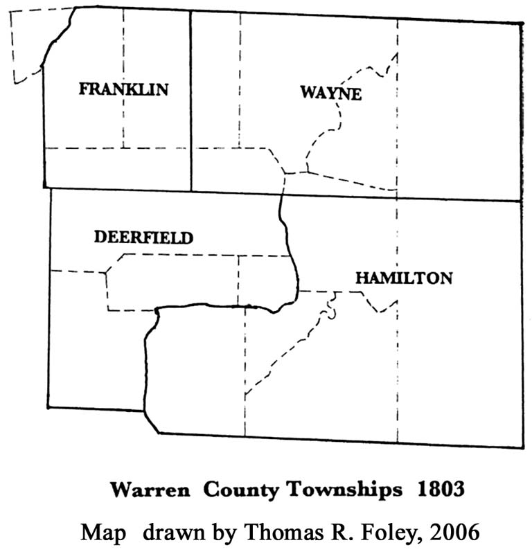 |
1803 Warren County formed from Hamilton County in 1803 with 4 original townships named Franklin, Wayne, Deerfield and Hamilton |
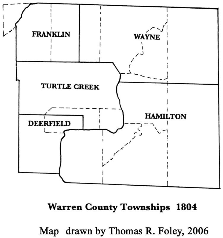 |
1804 Turtlecreek Township formed from parts of of Franklin, Wayne & Deerfield Townships |
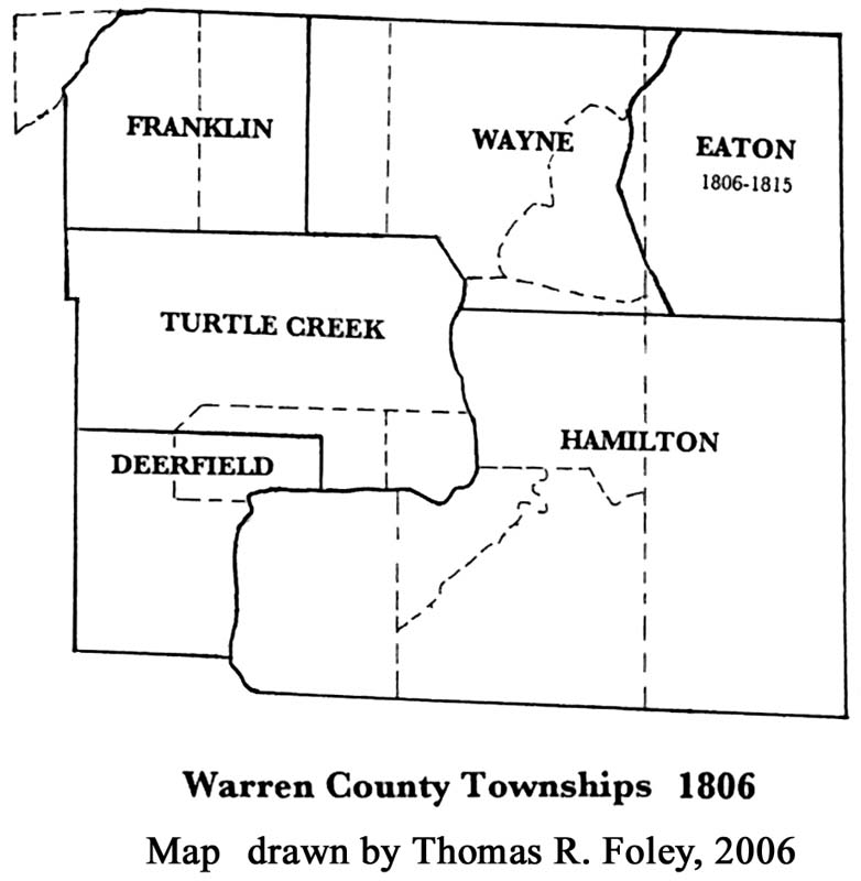 |
1806 Eaton Township formed from the eastern part of Wayne Township. |
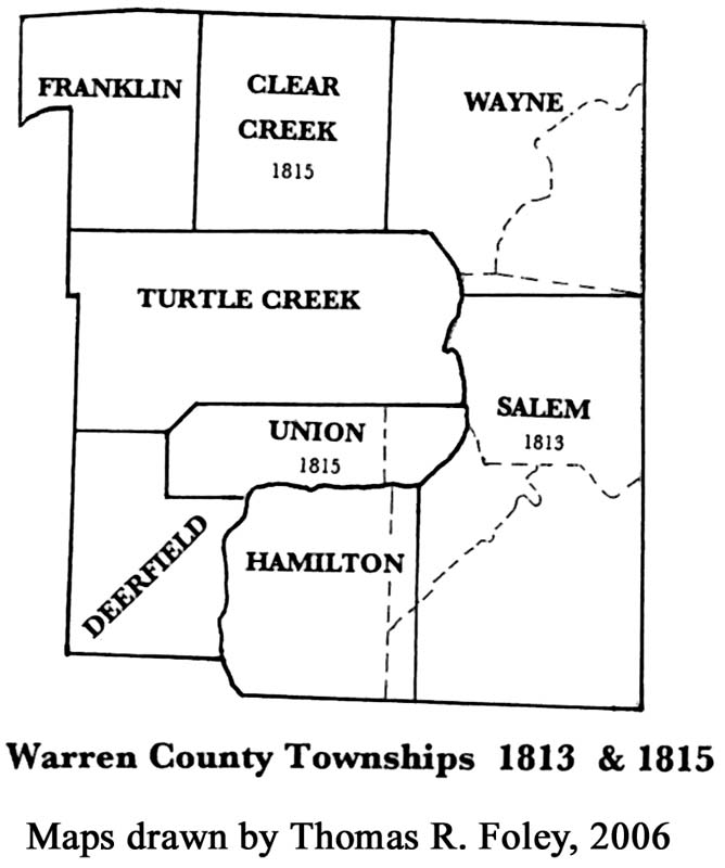 |
1813 Salem Township formed from the eastern part of Hamilton Township. 1815 - Eastern part of Warren county transferred to Clinton County to include all of Eaton Township & part of Hamilton Township - Land west of the Great Miami transferred from Butler County to Warren County and added to Franklin Township - Union Township formed from parts of Deerfield and Turtlecreek Township - Clearcreek Township formed from parts of Franklin & Wayne Townships |
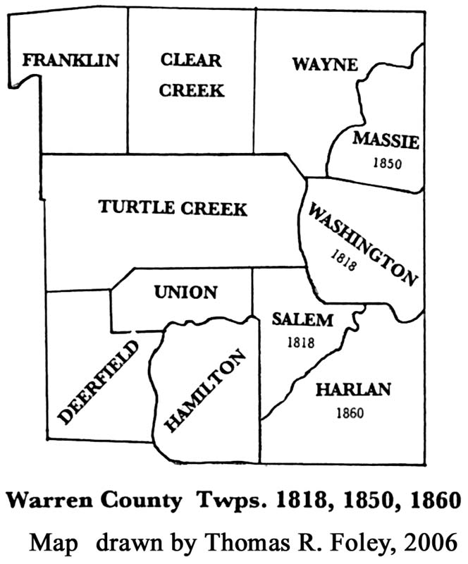 |
1818 - Washington Township formed from parts of Salem and Wayne Townships - Land west of the Little Miami River transferred from Union Township to Salem Township 1850 Massie Township formed from Washington Township 1860 Harlan Twp formed from Salem Township and Salem Township renamed Corwin Township. The was soon changed back to Salem Township. |
![]()
©2006-2010 Warren County Genealogical Society
For Non-commercial Use Only
This page was created 24 July 2006 and last updated on
01 September 2010
![]()